Earth Resistance (ER)

Measures the difficulty of passing an electric current through the ground. Effective for detecting features with different moisture content from the surrounding soil, such as foundation remains and ditches.
A man using earth resistance tools

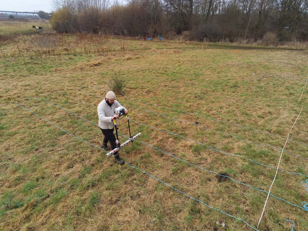
This technique measures the difficulty of passing an electric current through the ground. Effective for detecting features with different moisture content from the surrounding soil, such as foundation remains and ditches. We deploy a multiplex probe system, which can easily be configured to collect data at different probe separations to provide different depths of investigation according to the requirements of your project.

Share

Our techniques

Learn more about the techniques that we use.

Earth Resistivity Tomography (ERT)

Multiple earth resistance profile measurements are fused to create 2D sections and 3D profiles of electrical resistivity through the ground, commonly used to determine the depth of known features.

Photogrammetry

Uses high-resolution cameras to create accurate and detailed topographical maps, scaled plans and 3D models of assets, sites and landscapes for use in mapping, topographic survey, inspections and monitoring.

Magnetic Susceptibility

Measures the ease with which a material can be magnetised. Effective for detecting features with magnetic contrast from the surrounding soil, including burnt features, pits, ditches, and intra-site activity zones.

Get a quote

Tell us about your project and we’ll let you know how we can help.