Earth Resistivity Tomography (ERT)

Multiple earth resistance profile measurements are fused to create 2D sections and 3D profiles of electrical resistivity through the ground, commonly used to determine the depth of known features.
The team at work

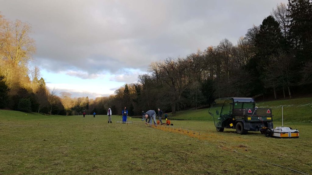
This technique is similar to earth resistance, but uses lines of fixed electrodes to create 2D slices and 3D views of changes in earth resistance at different depths. Typically, this can be used to model the depth and shape of known features, such as buried landforms or extraction pits.

Share

Our techniques

Learn more about the techniques that we use.

Ground Penetrating Radar (GPR)

Measures the travel time of reflected high-frequency electromagnetic radiation. Effective for detecting abrupt interface changes and voids, for example foundation remains, graves, burial chambers and cellars.

Photogrammetry

Uses high-resolution cameras to create accurate and detailed topographical maps, scaled plans and 3D models of assets, sites and landscapes for use in mapping, topographic survey, inspections and monitoring.

Aerial Photography and Videography

Aerial views provide unique, breath-taking perspectives, capturing assets, sites and landscapes as images, videos or photospheres. Perfect for reconnaissance surveys, settings assessments or promotional campaigns.

Get a quote

Tell us about your project and we’ll let you know how we can help.