Multispectral Imaging

Primarily used in precision agriculture, environmental surveys and forestry, this specialised sensor can also detect cropmarks caused by archaeological and other subsurface features.
A multispectral image of a field

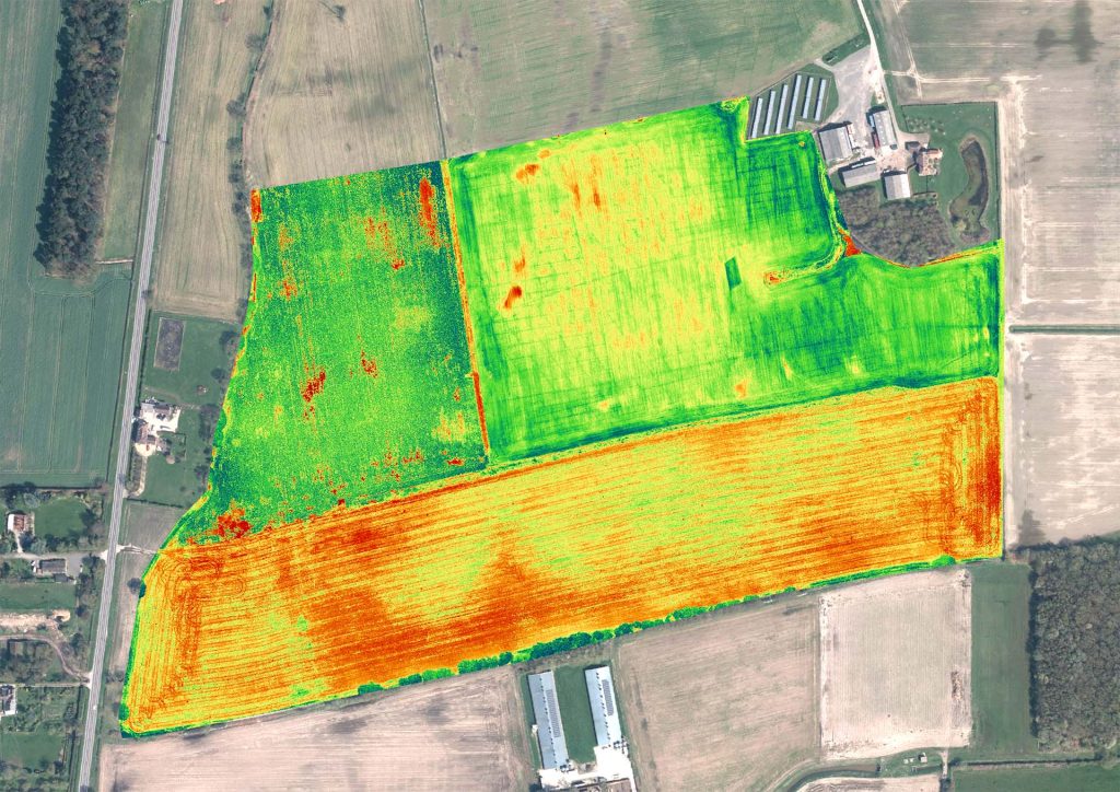
A technique borrowed from precision agriculture, this aerial survey method uses a cluster of light sensors tuned to specific light wavelengths or ‘bands’ to detect changes in plant health which aren’t visible to the human eye.

The data can be used by agronomists and foresters for a range of monitoring and inventorying procedures, for example identifying drainage problems, disease or invasive species. It can also be used as an archaeological prospection technique for detecting cropmarks that would otherwise be invisible, faint or unclear.

Share

Our techniques

Learn more about the techniques that we use.

Electromagnetic Conductivity (EM)

Measures the ease of which current flow can be induced in material. Effective for detecting conductive features, such as geomorphology and subsurface landforms, ditches and earthworks.

Magnetometry

Measures the ambient magnetic field strength. Effective for detecting features with magnetic contrast from the surrounding soil, including burnt features, pits and ditches.

Multispectral Imaging

Primarily used in precision agriculture, environmental surveys and forestry, this specialised sensor can also detect cropmarks caused by archaeological and other subsurface features.

Get a quote

Tell us about your project and we’ll let you know how we can help.